GroundTEM Trek
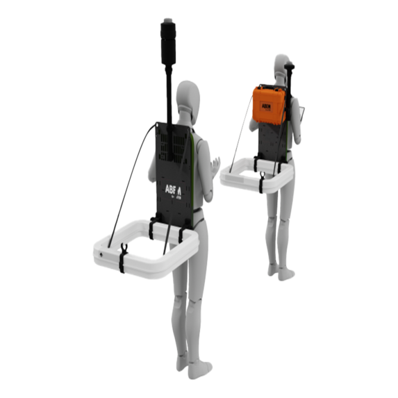
The ABEM GroundTEM Trek is a backpack-portable professional TEM system offering high mobility in all types of terrain. It has been developed for mapping subsurface geology in hydrogeology, geotechnical surveys, and mining applications.
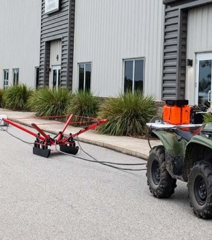
Thanks to its lightweight transmitter and receiver modules, it provides effective measurement opportunities in remote and difficult-to-access sites. With its wireless system architecture, continuous data recording, and real-time field imaging features, it provides an innovative and efficient solution for near-surface geophysical research requiring true mobility.
- Backpack-portable professional TEM system
- High mobility in all types of terrain
- Structure developed for hydrogeology, geotechnics, and mining applications
- Lightweight backpack-type transmitter and receiver modules
- Effective use in remote and difficult-to-access sites
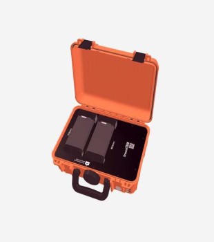
- Separate transmitter and receiver units weighing approximately 12–15 kg
- Continuous data collection capability while walking
- Structure suitable for mapping subsurface structures in the 50–100 m depth range
- Continuous data recording with GNSS and altitude tracking
- Real-time data processing support with premium features
- Instant field viewing of inversion results via mobile application
- Wireless system architecture
- Design eliminating the use of cumbersome cables
- Opportunity for safer and faster operation in challenging terrains
- Suitable for use on steep slopes, forested areas, and irregular construction sites
- Effective operational capability in areas where vehicle access is not possible
Application Areas
Groundwater Research
- High sensitivity to conductive units
- Differentiation of fresh, brackish, and saline water zones
- Monitoring of water level drawdown and recharge processes in aquifers
- Determination of aquifer distribution and boundaries through profile or grid-based measurements
- Contribution to the identification of aquifer zones and prevention of saltwater intrusion
Environmental and Geotechnical Applications
- Identification of clay units that may pose a risk
- Mapping of permafrost thickness
- Monitoring of contamination plumes
- Identification of subsurface risks prior to excavation
- Contribution to reducing project delays
- Assessment of bedrock depth, clay levels, and subsurface barriers
Mineral Exploration
- High sensitivity to conductive mineral bodies
- Rapid data collection in the exploration of new mineral deposits
- Contribution to more accurate planning of drilling points
- Infrastructure that increases efficiency in exploration studies