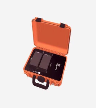

GroundTEM Ralli
The ABEM Ralli, a part of the ABEM GroundTEM platform, is an advanced TEM solution developed for fast and high-resolution subsurface mapping. Developed in collaboration with TEMcompany, this innovative system offers high efficiency and precise data generation in field studies.
Designed for the detailed imaging of groundwater and geological structures, the ABEM Ralli supports detailed modeling studies by providing reliable subsurface data up to a depth of 200 meters. Thanks to its structure optimized for rapid setup and effective field operations, it provides practical and efficient usage.
- Advanced TEM system that is part of the ABEM GroundTEM platform
- Structure developed for fast and high-resolution subsurface mapping
- Innovative system developed in collaboration with TEMcompany
- Design providing high efficiency in field studies
- Measurement infrastructure optimized for precise data generation
- Suitable for imaging groundwater and geological structures
- Providing reliable subsurface data up to 200 m depth
- System structure contributing to detailed subsurface modeling
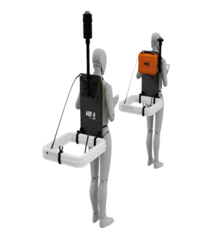
- Rapid installation capability
- Usage optimized for effective field operation
- System architecture suitable for practical field applications
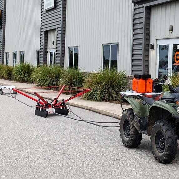
- Semi-mobile and mobile system options
- Infrastructure suitable for fast area scans
- Support for deep investigation applications with systems offering high output current
Application Areas
Groundwater Research
- High sensitivity to conductive units
- Differentiation of fresh, brackish, and saline water zones
- Monitoring of water level drawdown and recharge processes in aquifers
- Determination of aquifer distribution and boundaries through profile or grid-based sounding measurements
Environmental Applications
- Rapid data acquisition
- Identification of clay units that may pose a risk
- Mapping of permafrost thickness
- Monitoring and evaluation of contamination plumes
Mineral Exploration
- High sensitivity to conductive mineral bodies
- Powerful use in the exploration of new mineral deposits
- Fast area scans with semi-mobile and mobile systems
- Infrastructure suitable for deep investigation applications